Skip to content
GCGC INTEGRATIVE
Physiotherapy & Wellness

Community Impact / Gallery

In preparation

Images, with context.

Satellite evidence, original news reporting and photographs with clear sources and dates.

Nepal / Disaster context

Real images.
Dates and sources attached.

These satellite observations document the 2026 disaster. They are separate from our future Physio-Qi session photographs and do not show work funded by GC Integrative.
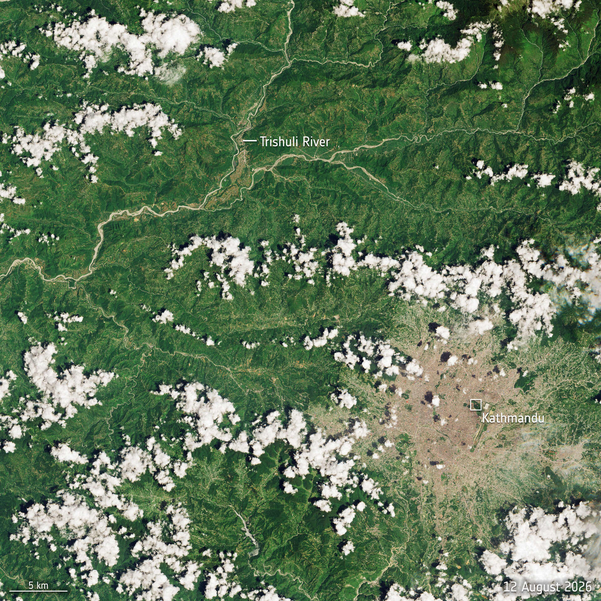
Trishuli River before the flood, 12 August 2026, natural colour.
Before · 12 August 2026. Sentinel-2 captures before and after Nepal flash flood. Contains modified Copernicus Sentinel data (2026), processed by ESA. CC BY-SA 3.0 IGO. Unchanged.
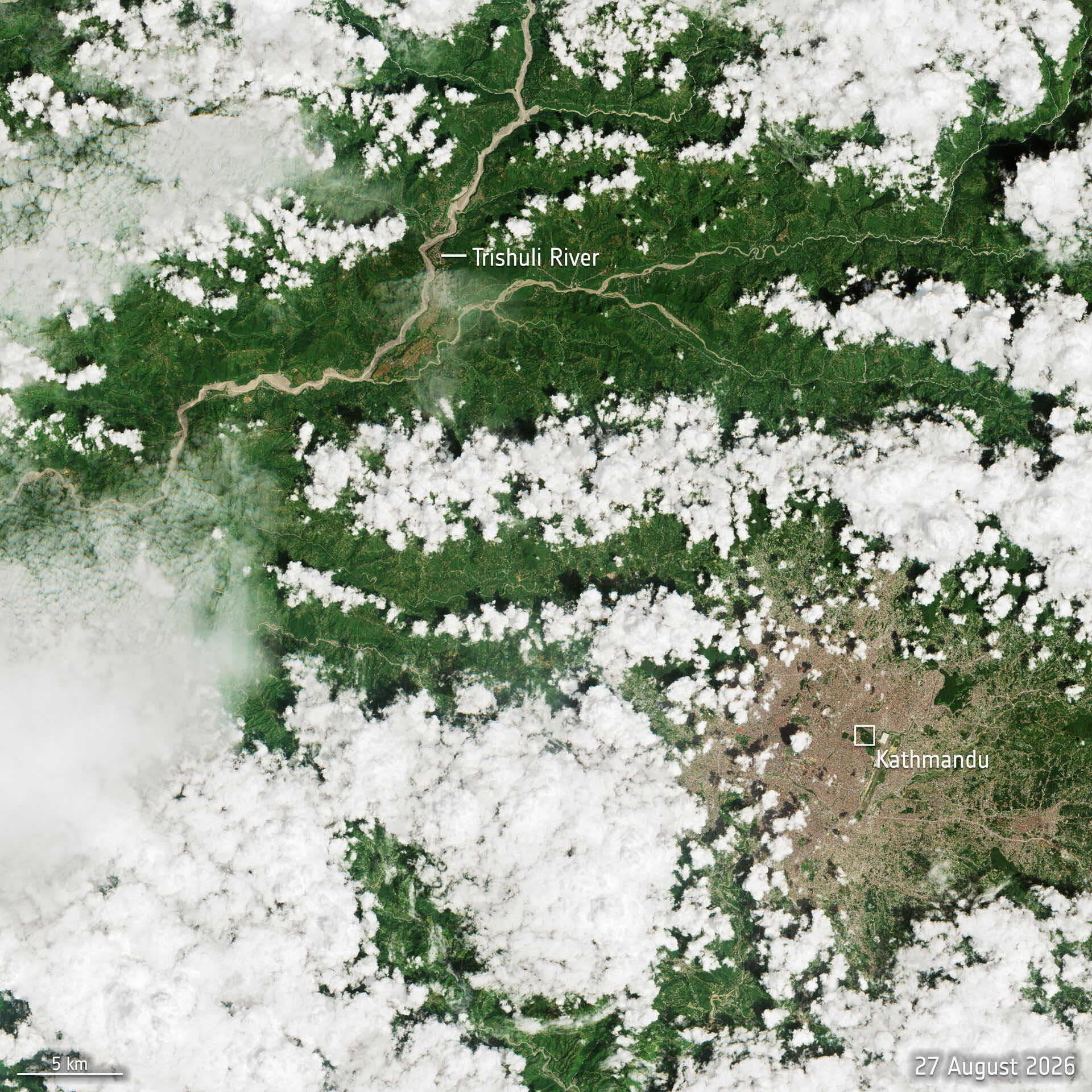
Trishuli River after the flood, 27 August 2026, natural colour.
After · 27 August 2026. Same ESA source, credit and CC BY-SA 3.0 IGO licence as the before image. Unchanged.
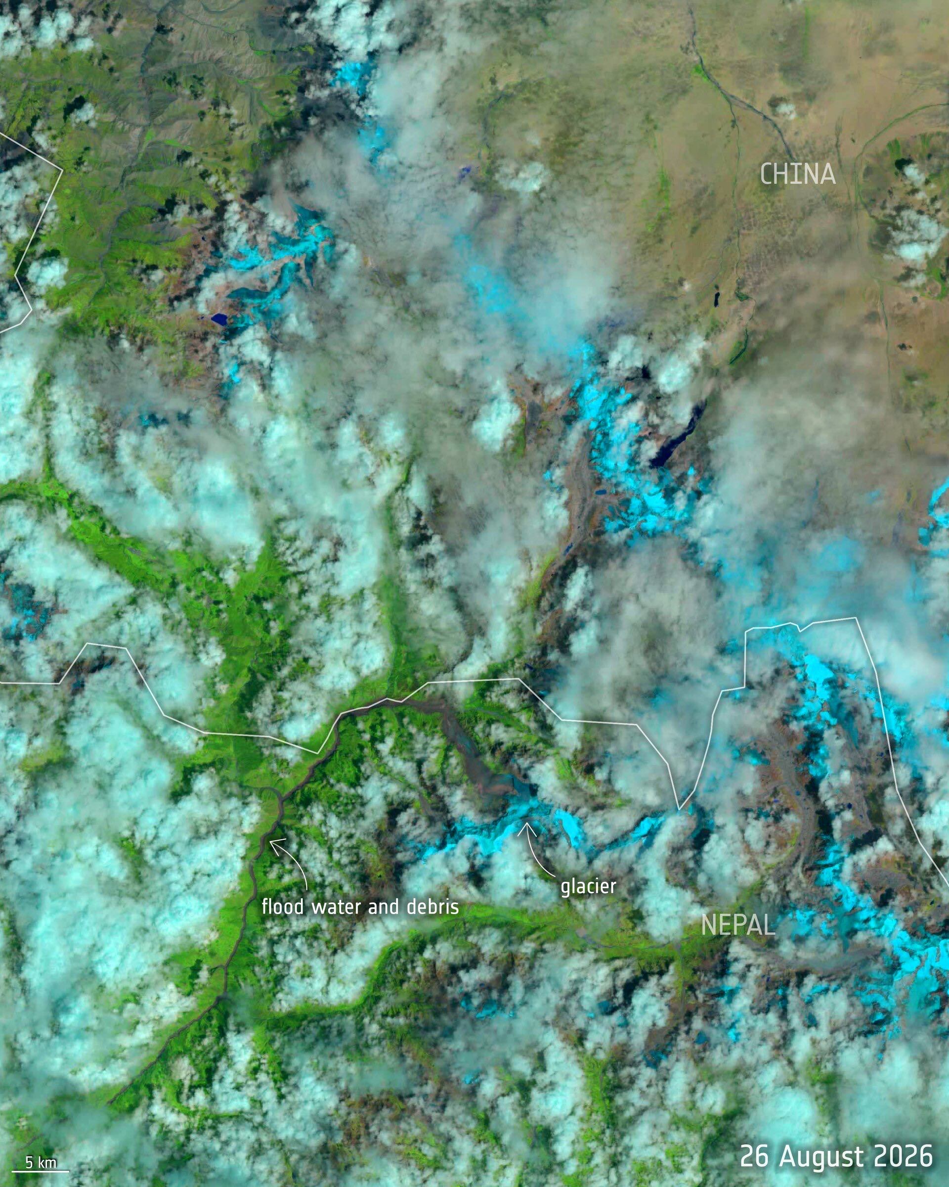
Shortwave-infrared Landsat-9 image of the glacier and floodwater near the Nepal–China border, 26 August 2026.
Nepal glacier collapse and flood – before and after. Contains Landsat-9 data, processed by ESA. CC BY 4.0. Unchanged.

26 August 2026 / Landsat-9

The source of the surge.

A processed shortwave-infrared view, captured about two hours after the collapse. The colours help distinguish features; this is not a natural-colour photograph.

Our community photographs

No GC campaign session photographs are approved for publication yet. They will be added with permission, dates and event context.